SAEF scientists have developed new mapping technology to enhance the monitoring and conservation of Antarctic Specially Protected Areas (ASPA).
The research combines the use of drones, photography, sensors, and machine learning to map and detect Antarctica’s unique moss and lichen. These are the only vegetation that can survive the region’s extreme environment, where water is locked up in ice and sunlight disappears for half the year.
Antarctic moss and lichen provide habitat for tiny organisms, such as tardigrades and springtails, fostering a delicate ecosystem in miniature. However, it is increasingly under threat from climate change and increased human activity.
Dr Juan Sandino, a research fellow from SAEF based at QUT, said that monitoring the health of these ecosystems is challenging due to the region’s remoteness and harsh environment.
“The traditional method of having scientists conduct surveys by foot is time-consuming, costly and risks causing disturbance to this fragile environment. Even newer methods using satellite imagery have limitations in this context due to low image resolution and the region’s near-constant cloud cover.”
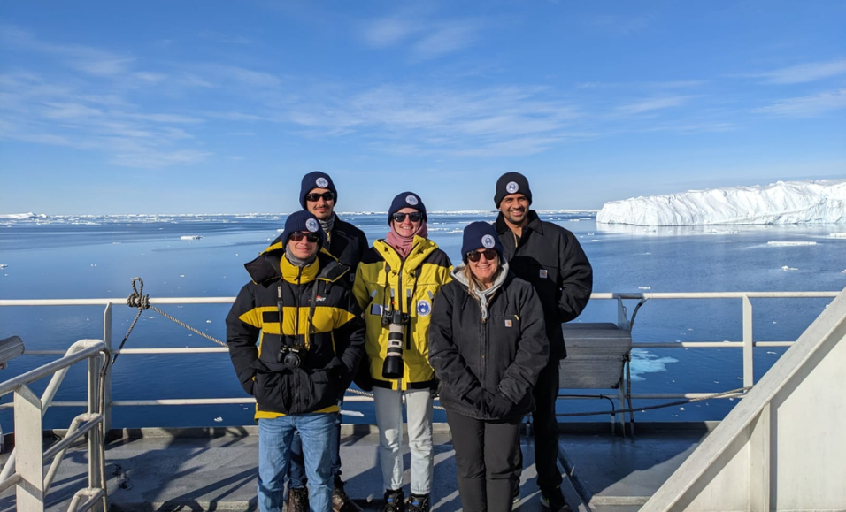
To come up with a solution, SAEF scientists from QUT and the University of Wollongong teamed up to improve the mapping and monitoring technology available.
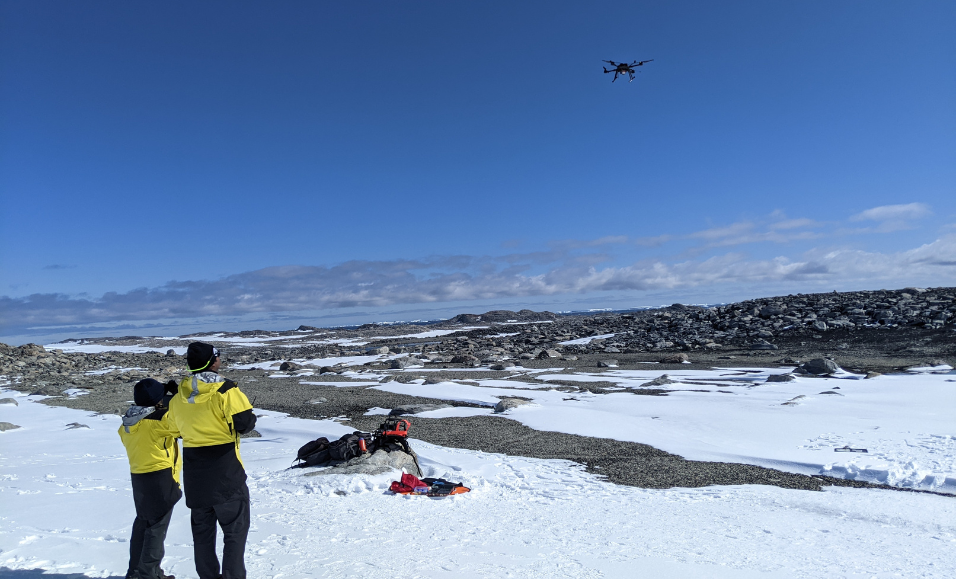
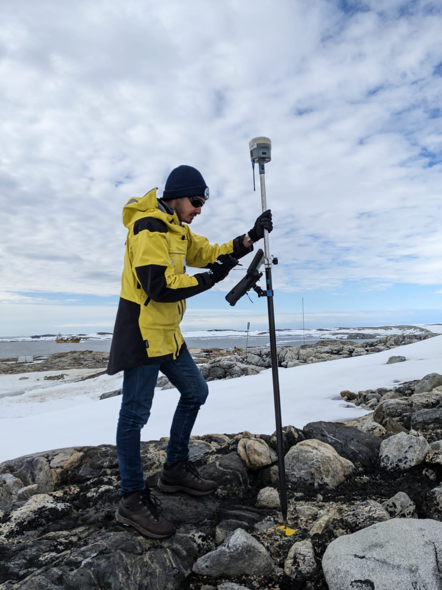
Members of the research team travelled to Antarctica in January 2023 to conduct fieldwork in ASPA 135, an area near Australia’s Casey Station which has some of the continent’s most extensive moss beds.
Here the team used drones to gather high-definition multispectral and hyperspectral imagery, as well as ground control data.
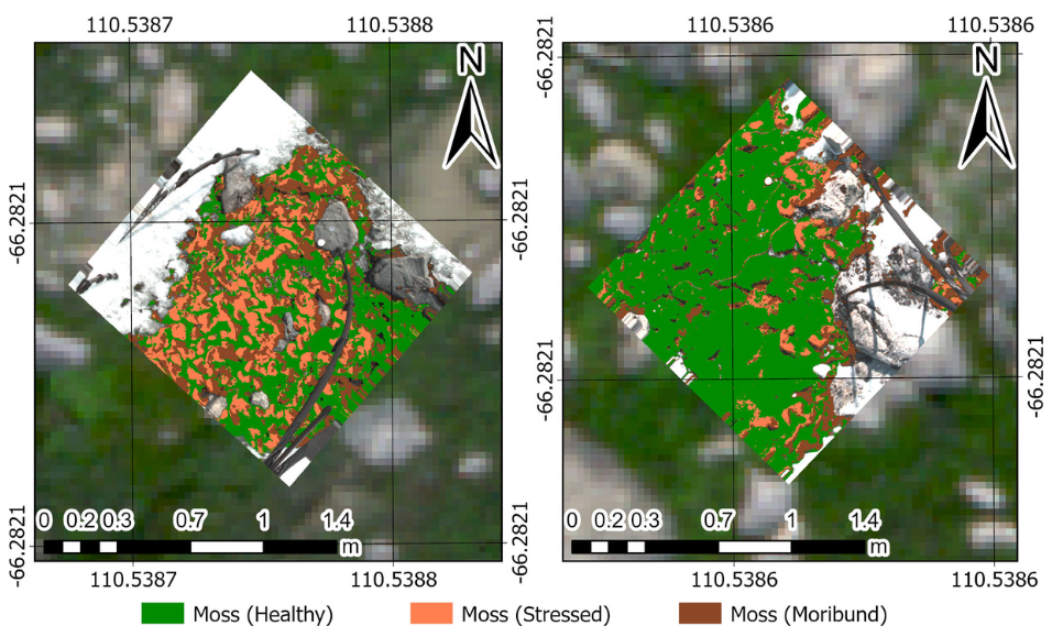
Dr Sandino said that once back in the lab the team processed 500 GB of data and used machine learning to produce a high-definition map of the ASPA and the health of its vegetation.
“We identified new spectral indices to help identify the moss and lichen from the rock and ice. This has enabled the development of a new model using machine learning to significantly enhance the detection of vegetation with 95% accuracy.”
The technology will be further tested and developed this summer during the Australian Antarctic Program’s Denman Terrestrial Campaign, the nation’s most ambitious remote science campaign in decades.
“Members of our team will use drones fitted with RGB, thermal, multispectral and hyperspectral cameras to collect data to create high-resolution maps of the Bunger Hills region,” Dr Sandino said.
“These maps will show the location, condition and distribution of the moss and lichen and contribute valuable data for monitoring and conservation planning to protect the region’s unique environments.”
Professor Felipe Gonzalez, a chief investigator from SAEF at QUT said the research laid the groundwork for more extensive mapping of Antarctic ecosystems.
“This new mapping and detection technology enables more effective monitoring of the health of Antarctic ecosystems and will be an invaluable tool to support decision-makers in conservation planning and management in the context of a changing climate.”
Read more
Sandino, J., Bollard, B., Doshi, A., Randall, K., Barthelemy, J., Robinson, S.A. & Gonzalez, F. A (2023) Green Fingerprint of Antarctica: Drones, Hyperspectral Imaging, and Machine Learning for Moss and Lichen Classification. Remote Sens. 15, 5658. https://doi.org/10.3390/rs15245658