fbpx

Researchers of the Lost Ice

If it were an adventure film it might be called Researchers of the Lost Ice. Set against the backdrop of East Antarctica’s remote and mysterious Bunger Hills, scientists (including a globe-trotting Dr Jones) spend 60 nights on the ice in tents withstanding blizzards and no showers in search of natural archives that hold the secrets to Antarctica’s past and future. 

It was even directed by a man named Steven. Although it was all strictly permitted (under the Antarctic Treaty there is no plundering of this continent’s national treasures) and there were definitely no snakes (well…the logistics to get there felt like a giant game of snakes and ladders). But it was all worth it. A few days after the team arrived they flew by helicopter to a frozen lake to start their fieldwork. 

“It felt like a long build-up to this point with many months of planning and weeks of waiting in Hobart to fly down south,” PhD student Jacinda O’Connor explains. 

“The moment when we pulled up our sediment corer and opened it to reveal a well-in-tact core with visible layering was very satisfying, and I was thrilled to have just collected the first sample of my PhD.”

This sediment core is a prized record of past sea level change and was collected as part of Australia’s most ambitious deep-field science campaign since the early 2000s. The Denman Terrestrial Campaign has taken years of planning, sparked by the need to understand one of East Antarctica’s largest and fastest retreating glaciers, the Denman Glacier. 

In recent decades the glacier has retreated over 5 km, and scientists can’t accurately predict how it will change in the future. They do know that if it were to melt entirely, it would raise sea levels by 1.5 m. 

In fact, scientists don’t know much about the Bunger Hills region more broadly. Since it was first sighted in the late 1940s during the U.S. Navy Operation “Highjump,” there have only been a handful of expeditions to the region led by the Soviet Union, Poland, and Australia. Set amongst a sea of ice, the Bunger Hills are an isolated assemblage of rocky outcrops dotted with over 200 lakes about 450 km west of Australia’s Casey Station. While it may seem lunar-like and desolate, these ice-free areas are sometimes referred to as an Antarctic oasis as they are one the few places where biodiversity can eke out a living. The Bunger Hills is one the largest ice-free areas on the continent and features some of its largest lakes, including the rather simply described Lake Algae. 

Data is scarce, which means not only is the region’s environmental history and biodiversity mostly a mystery to us but as it comes under increasing threat from climate change, nobody has enough information to understand the case for its conservation. 

Building this picture requires the collaborative effort of scientists from across the disciplinary spectrum, from glaciology to ecology and chemistry to engineering. In this adventurous campaign, researchers have been drawn from across the Australian Antarctic Program, including the Australian Antarctic Division (AAD), Securing Antarctica’s Environmental Future, the Australian Centre for Excellence in Antarctic Science (ACEAS), and the Australian Antarctic Partnership Program (AAPP). 

In December 2023, after a long game of snakes and ladders, a team of around 40 scientists and support personnel arrived at the remote field camp, Edgeworth David base, to spend the next two months living in tents and spending their days completing fieldwork. 

It was Monash University glaciologist Dr Richard Jones’s fifth expedition to Antarctica, and he says it was by far the most challenging but rewarding of all of them. 

“It was special to be part of this diverse group of scientists, which resulted in lots of cross-disciplinary discussions over cups of Milo and board games. Everyone wanted to support each other’s projects, whether this included sharing helicopter trips or helping dig out equipment buried under metres of snow. I can see many collaborations coming from this work, which would not be possible without such a deep-field expedition.”

Scientists and the Kingdom of Antarctic Life

One of the campaign’s most collaborative elements was the work of Dr David Clarke, Laura Phillips, and Dr Toby Travers. All ecologists by training, they were tasked with collecting samples and conducting surveys on behalf of SAEF team members working on a vast array of interdisciplinary projects. 

99% of all known terrestrial Antarctic biodiversity resides in ice-free areas, making the Bunger Hills a boon for biologists. “It’s a little slice of life amongst a frozen desert,” Phillips says.

“There is relatively little known about both the biodiversity within the Bunger Hills and the many lakes that are situated throughout the area,” Dr Clarke explains, “and what is known is relatively outdated. The data we collected will help us learn more about how multiple aspects of biodiversity (i.e., microbial, invertebrate, vegetation) are structured across space.”

Under SAEF’s biodiversity status and trends research theme, scientists are looking to answer questions like: what species live here, which environmental variables are driving their distribution, how are the organisms related and how will they be affected by the changing environment? 

While in the Bunger Hills, the typical day would start with the generators waking everyone up at 6 am, followed by breakfast and the morning briefing. By 9 am the team was often in a helicopter being flown out to where they’d be conducting their work for the day. Once dropped off, they would spend the day hiking around, traversing the rocky and sometimes steep terrain, collecting water, soil and, if it could be found, moss, their backpacks getting heavier and heavier as they accumulated samples on top of the 5-10 kg of survival gear that was compulsory to carry at all times. 

The surveys sought to identify the presence of vegetation, such as moss, lichen, algae, and microbial communities alongside details of their environment such as soil salinity, water sources, and signs of seabird presence. The soil samples will help discover what microbes and invertebrates live in the region, while the lake water samples will provide baseline information about water chemistry.  

“The lakes can subsequently be used as early indicators of environmental change that may be occurring in the area,” Dr Clarke explains. 

The moss cores can tell us about past climate conditions, including water availability over decades at a microclimate scale, and provide insights into large-scale processes such as glacial retreat and local sea-level change. “Stumbling upon a particularly luscious patch of moss or lichen was always a win. And that’s just what we could see with the naked eye – I’m excited to discover what forms of life will be found in the soil samples!” Phillips says. 

It was tough work made easier by spectacular views, the uncanny silence, and the sense that they were some of the few people on Earth lucky enough to enjoy them. Once the team had completed their sampling for the day, they would arrange for the helicopters to pick them up and take them back to camp. Evenings consisted of sorting the day’s samples, having dinner, attending the evening briefing, and planning for the next day. 

Dr Clarke says that it was notable how simple daily life was during the expedition, “Even during the chaotic and stressful moments there was an odd sense of peace. It’s harder to come across this simplicity back home.”

The team has returned to Australia with over 850 bags of soil, 41 moss samples, and 100 litres of water, sent to team members based in Melbourne, Wollongong, and Canberra. As Dr Clarke explains, “All this information gathering will help us better understand the environmental and biodiversity changes the area may experience in the future, whilst providing important data for future intra- and inter-region comparisons.”

Dr Jones and the Rock of Destiny

Another way the expedition will help scientists better predict future change in Antarctica is by offering a window into how the Denman Glacier has changed over past millennia.  

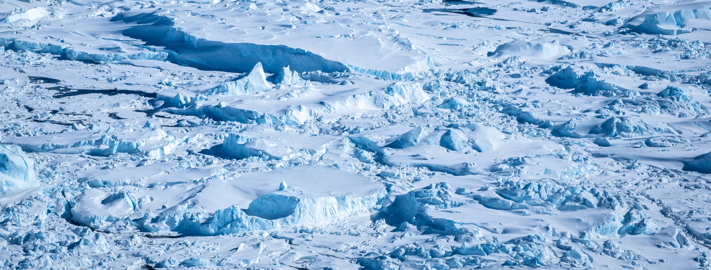
Dr Jones says that the glacier has retreated over 5 km in recent decades, “We don’t know whether this is normal or the start of a worrying new trend.” At what points was it retreating, stable, and advancing, and what were the associated climatic conditions? 

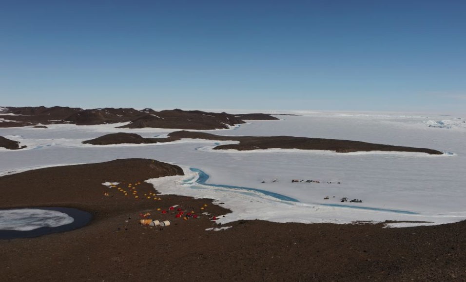
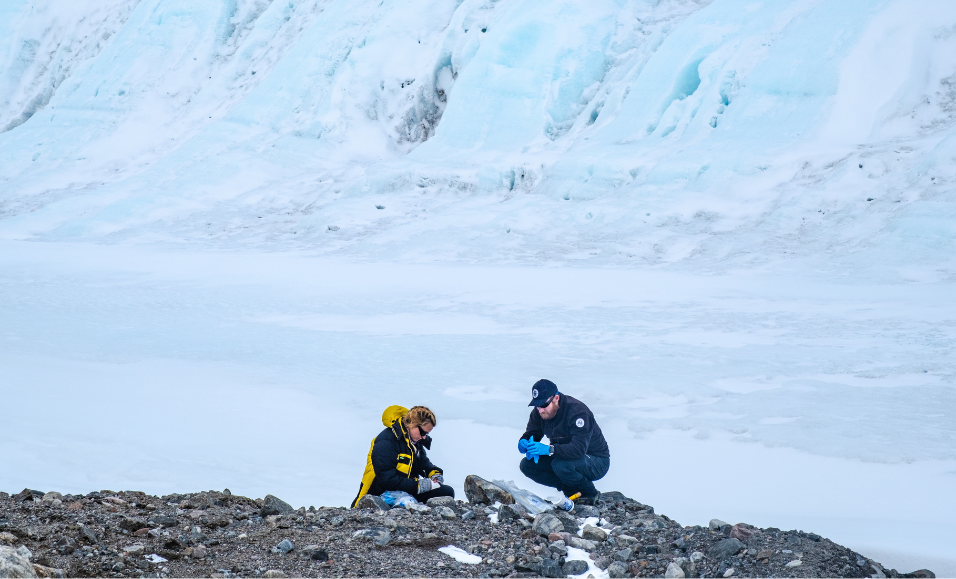
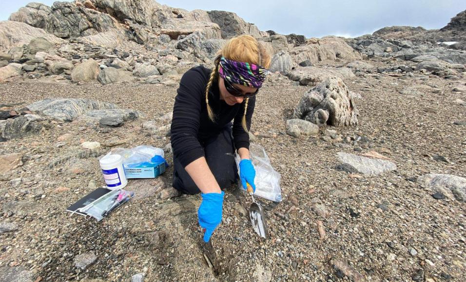
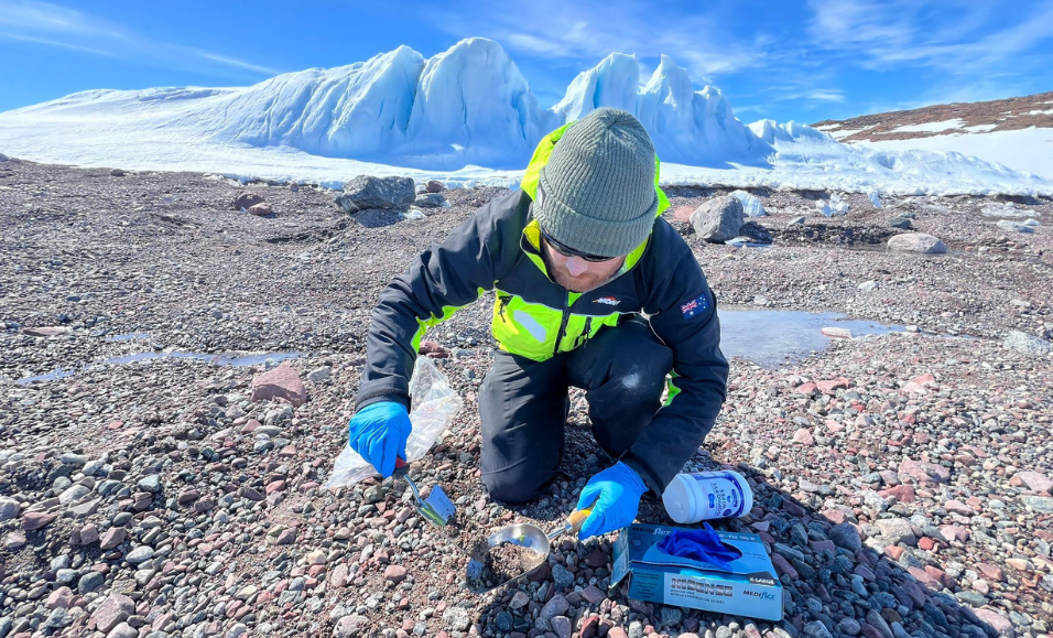
He and his Monash University team, including Dr Levan Tielidze and PhD students Jacinda O’Connor and Corey Port, were on a mission to collect glacial rocks, lake mud, and beach sand—useful archives that offer a window into past glacier change.  

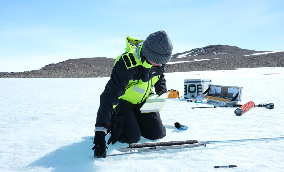
The beach sand and lake mud record past sea level change. The team collected the former by digging pits into a sequence of terraces along pebbly bay shores, while to collect the lake mud, the team needed to drill through 2 to 3 metres of lake ice and then push their corer through another 1 to 3 metres of water to reach the lake bottom where they could pull up rich and darkly layered cores. 

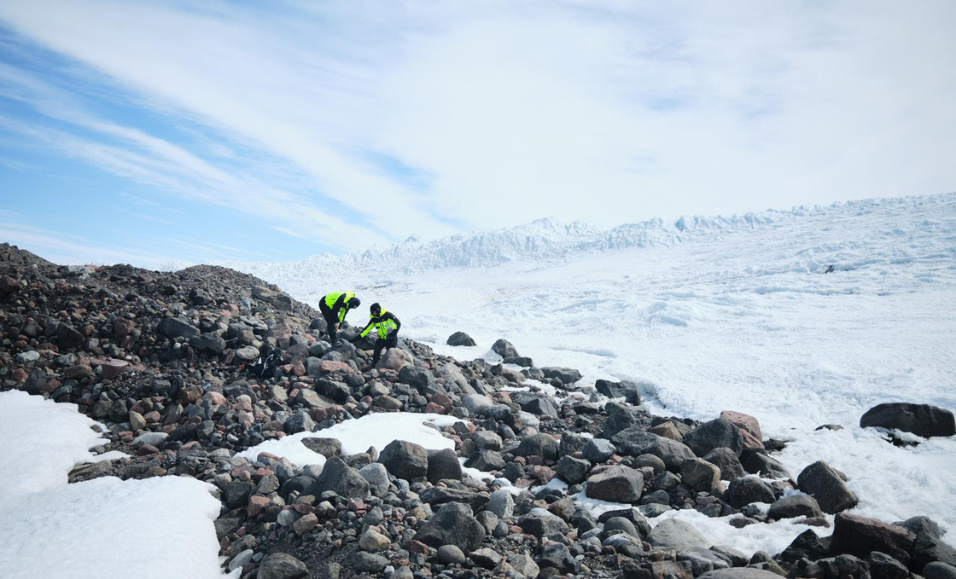
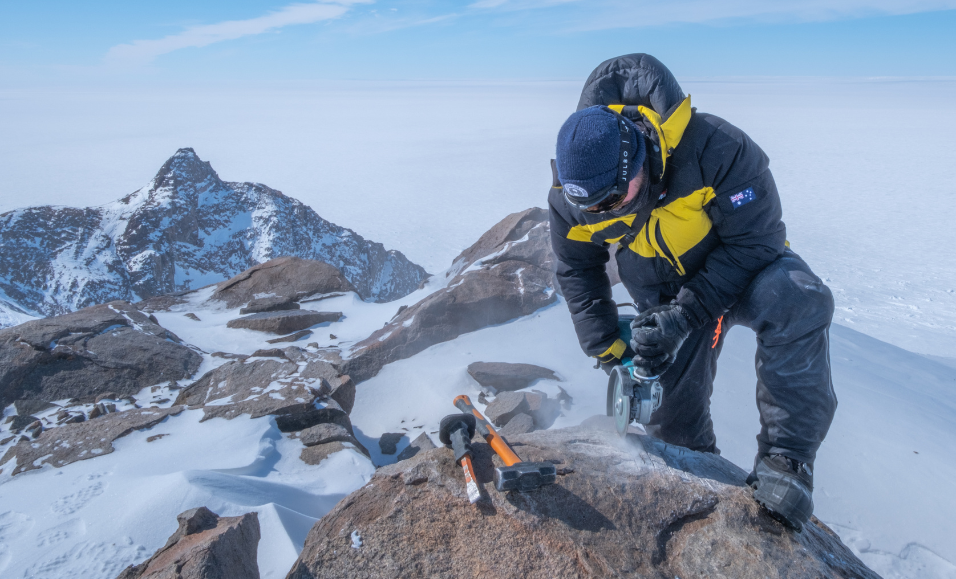
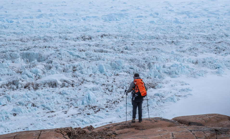
Meanwhile, alongside the Denman Glacier, nunataks, which are mountains that protrude through the surrounding ice, offer rock samples that record glacier thickness change. 

“These rock samples are useful as they essentially act as stopwatches,” Port explains, “recording the time since they were uncovered via the accumulation of cosmogenic isotopes – chemical signals that are produced within minerals contained in the rock (such as quartz) by cosmic ray bombardment.”

“By understanding the concentration of cosmogenic isotopes in samples at different elevations, we can understand how the glacier has thinned over time.”

When the team arrived at a site, they would traverse to the closest point of the nunatak to the ice, looking for potential samples along the way and evidence of glacial erosion, such as scratch marks and lack of weathering. They would then work their way back up the nunatak, collecting samples every 5 – 10m of elevation, using angle grinders, rock corers, hammers, and chisels. 

“Along the way our packs would get heavier, and the whole thing became a race against time. When would that helicopter be picking us up? Sometimes a lot earlier than planned!” Port says. 

Before their departure south, the team spent hours poring over maps and satellite imagery trying to understand the landscape they would eventually set foot upon. “Although we quickly found out that satellite imagery is a poor substitute for being there on the ground!” Port says. 

The locations the team visited were much more dramatic and challenging than they’d anticipated, and the conditions differed at each. 

“Cape Jones, where we spent a glorious week, felt tropical (to Antarctic standards!) Katabatic winds would blow throughout the night and in the early morning, but eventually, these would die down and leave us with still, sunny days,” says Corey. 

“Further upstream along the Denman Glacier stood Mt Strathcona and Mt. Barr-Smith. Attempts to reach their heights were often canceled by winds exceeding 50 knots, which are especially perilous along Strathcona’s steep cliffs and high elevations.”

“When ‘good’ days came around and we made it up there, winds were still biting cold and unwavering. I recall attempting to turn my back to the wind to get a reprieve from the snow for a moment, but the wind would circle around my back and blow the snow back at me.” 

“Despite the weather, the views at both these sites were spectacular and dramatic, truly an Antarctic experience.”

This phrase was used by several scientists, particularly in relation to the extreme and unpredictable weather. On one particular day, Dr Jones and O’Connor were out doing some surveying when the weather suddenly turned. In blizzard conditions, it took them an exhausting four hours to hike back to camp. Dr Clarke, Phillips, and Dr Travers also spent an unplanned night out when the weather suddenly deteriorated, and the helicopter was unable to pick them up. Clarke says, “It was windy and snowing but the camp was actually quite fun, especially given that we were safe, and eating lots of chocolate from the survival kits.” A true Antarctic adventure.

While the team had great weather in December, this didn’t last into January, which meant that they had to adjust the scope of their work and devise alternative plans. 

“Luckily, part of our planning was coming up with priorities and backup plans, and more backup plans. In saying that more backup plans were eventually made in the field, as the realities of working in an extreme environment and being subservient to the whims of the weather became apparent,” says Port. 

Fortunately, the team managed to collect samples at all their sites and they have now returned home “happy and exhausted” with 215 kg of rock, 13 lake sediment cores and 20 kgs of beach sand. Now the team has many months ahead of them processing the samples in the lab and analysing the data in the offices to unveil the glacier’s history. 

Drones and the Last Crusade

“After several weeks of fieldwork at the Bunger Hills, it was starting to feel like home,” Julian Galvez-Serna says. 

The camp and their daily routines were familiar and a close sense of community had formed among the scientists and support crew. “It was nice to have a sense of community down here being so far away from family and friends, without this it would have been hard to be away from home for so long,” Matt Swan says. 

Galvez-Serna and Swan, both drone pilots based at QUT, were tasked with mapping five regions of the Bunger Hills to collect data on the region’s vegetation. They used drones fitted with high-resolution RGB, thermal, multispectral, and hyperspectral cameras, completing over 100 flights.

“The data we collected will be used to train machine learning-based vegetation detection systems that can accelerate and support the understanding of Antarctic vegetation distribution and health,” Galvez-Serna explains. 

The resulting high-resolution maps of the Bunger Hills region will show the location, condition, and distribution of vegetation, including moss, lichen, and cyanobacteria, and contribute valuable data for monitoring and conservation planning to protect the region’s unique environments. 

After an intense race against time to complete their fieldwork by February, it was time to head home. Some flew to Casey Station, while others stayed back to pack up the camp ready for next season. After two months, most were looking forward to a proper show, sleeping in a normal bed, and wearing fewer layers of clothing. 

“We didn’t achieve everything we had planned, but in saying that, our plans were quite ambitious,” Dr Clarke says. “Nevertheless, we did achieve a substantial fraction of the plan, which was amazing, especially given the periods of bad weather and other operational disruptions that we experienced.”

Like all good adventures, there will be a sequel. The game of snakes and ladders is underway for the Denman Marine Voyage, another similarly large and collaborative voyage to understand the Denman Glacier, this time from where it meets the ocean. This will include collecting oceanographic measurements, sea ice data, and seafloor species, with an incredible cast of scientists whose work will offer fascinating insights into the region’s history for audiences worldwide.