New Antarctic Vegetation Mapping Method Combines Drones, AI and Hyperspectral Imaging

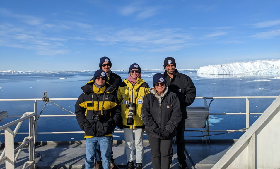
Dr Juan Sandino and his colleagues have developed a new method which harnesses the use of drones, hyperspectral imaging and AI to accurately map Antarctic vegetation. In the 2022/2023 summer, the team completed fieldwork in the Windmill Islands region supported by the Australian Antarctic Program. Antarctic moss from the Windmill Islands region. Credit: Emiliano Cimoli Five members of the multidisciplinary research team from QUT and UOW on their way to Antarctica in December 2022.


An interdisciplinary team of SAEF researchers has developed a new way to map moss and lichen in Antarctica with unprecedented precision—in a way that is quick, cost-effective and won’t disturb any plants.
Led by SAEF research fellow Dr Juan Sandino from QUT, the study, published in Scientific Reports, outlines a method that harnesses the use of drones, hyperspectral imaging and artificial intelligence to accurately detect and identify moss, lichen and cyanobacteria to produce high-resolution vegetation maps.
The team says these maps will support Australia’s ongoing monitoring and conservation efforts to protect Antarctica’s vegetation and the ecosystems they support, and that the methods could be adopted by other research groups and national Antarctic programs.
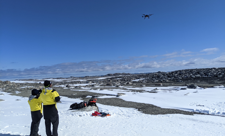
During the 2022/2023 summer field season, five SAEF researchers travelled to Australia’s Casey Station supported by the Australian Antarctic Program. The area where the station is located, in the Windmill Islands, is home to some of Antarctica’s most extensive and lush moss beds.
“Mosses and lichens are the green stress barometer of Antarctica,” said Dr Sandino. “Keeping track of their health is vital but extremely difficult in sub-zero field conditions.”
SAEF Deputy Director, Distinguished Professor Sharon Robinson from the University of Wollongong, who co-authored the study, has led efforts to monitor these moss beds for over 20 years. Her team’s research has shown that moss health is in decline due to changing climate conditions. The location of the moss beds, in a region which is remote, cold, and has limited access, makes it challenging to conduct year round monitoring. Sharon has recently commenced an Australian Laureate Fellowship that seeks to develop new, innovative methods of monitoring which are non-invasive and provide data in real time.
Conventional methods, such as the NDVI index—widely used in forests and fields to detect and identify plants using RGB or multispectral imaging—often misclassify low-lying polar plants. To overcome this, the team turned to hyperspectral imaging, which can distinguish plants based on their unique spectral signatures.
In the field, the team deployed a drone fitted with an RGB camera to capture high-resolution images of the moss beds, and hyperspectral sensors to collect spectral data. Geospatial data was also gathered on the ground.
Back in the lab, Dr Sandino used artificial intelligence to test multiple models capable of identifying Antarctic vegetation, including moss, lichen and cyanobacteria, using their spectral signatures. He developed a streamlined workflow that fuses three data streams: imagery, hyperspectral data and geospatial coordinates (GNSS-RTK).
The top performing models, CatBoost and UNet, achieved 99% accuracy. The team also validated six new spectral signatures of Antarctic vegetation, which significantly improved the model’s performance.
Their results also show that even sensors capturing a smaller number of wavelengths can produce accurate, high-resolution vegetation maps. “This opens the door to smaller drones, lower cost sensors, and smaller hyperspectral data requests,” said Dr Sandino.
By combining drone, hyperspectral imaging and artificial intelligence, the study offers a scalable and practical solution for monitoring Antarctic ecosystems, which will help inform decisions about how best to protect them as the climate changes.
The research was made possible through the support of the Australian Research Council, the Australian Antarctic Division and NVIDIA.
Read more:
Sandino, J., Barthelemy, J., Doshi, A., Randal, K., Robinson, S.A., Bollard, B. & Gonzalaz, F. (2025) Drone hyperspectral imaging and artificial intelligence for monitoring moss and lichen in Antarctica. Scientific Reports, 15, 27244. https://doi.org/10.1038/s41598-025-11535-4
