The Lessons We Can Learn from Sub-Antarctic Lakes
The lakes on Macquarie Island are largely a mystery to scientists. But new research is starting to unveil their secrets and the water processes that sustain them.

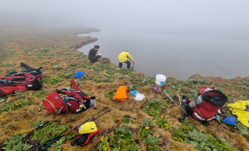
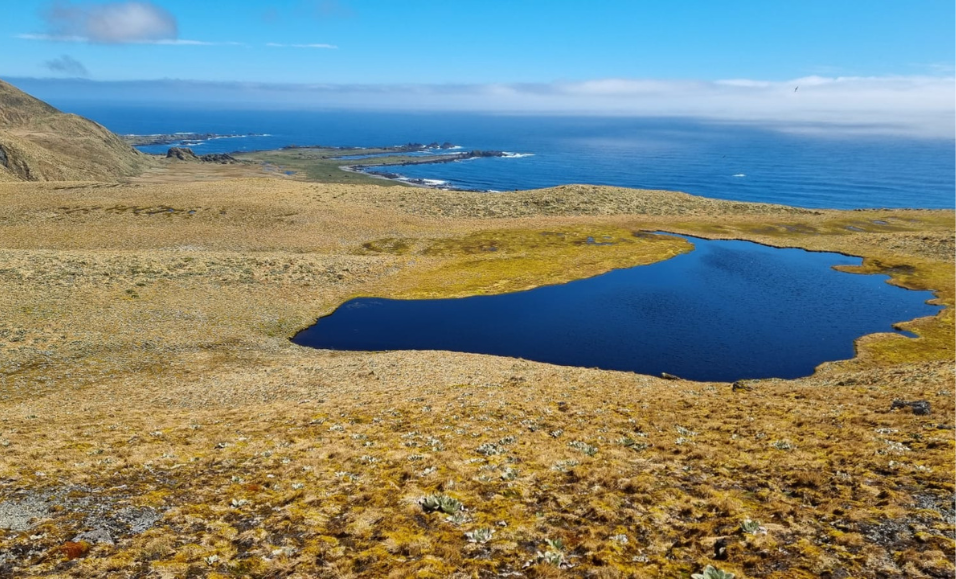
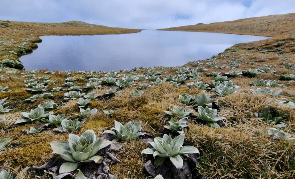
Researchers collecting water samples at Macquarie Island in 2022. Credit: Maggie Smith One of the many lakes at Macquarie Island. Credit: Maggie Smith One of the many lakes on Macquarie Island. Credit: Maggie Smith
On Macquarie Island, it rains an average of 316 days a year. The rain falls onto a landscape of wild, natural beauty with steep escarpments covered in green, tussock grasses and strewn with congregations of wildlife. The water soaks into the landscape or collects in creeks and flows overland, often arriving into one of the stunning lakes that dot the island’s plateau.
These lakes are a mystery to scientists, who have just begun to understand the “hydrology” of the island – or the way the water moves on and below Macquarie Island’s surface, sometimes ending up in a lake.
These largely unexplored bodies of water are attracting attention because of what they could unveil. Modelling predicts that in scenarios that see between 1.5 – 4 °C of global warming, rainfall could increase between 10% and 60% across the island. These lakes are key to predicting how its ecosystem will respond to future changes in rainfall, evaporation and groundwater.
A team of SAEF scientists led by Dr Karina Meredith and Dr Krystyna Saunders from the Australian Nuclear Science and Technology Organisation (ANSTO) are among those trying to understand Macquarie Island’s lakes and the water processes that sustain them.
In a recent paper published in Nature Scientific Reports, they presented the first comprehensive, island-wide survey of the water chemistry within Macquarie Island’s lakes.
What’s in the water?
In the summer of 2018, Krystyna organised a team of two scientists to spend several months on the island collecting lake samples. Each morning they would hike from small field huts, out onto the plateau and return each evening with hiking packs full of water and sediment samples.
While she wasn’t on this particular sampling trip, Krystyna has experienced both the beauty and brunt of working on Macquarie Island.
“The feeling of being picked up and blown off your feet by the wind is hard to describe, but it is impossible to ignore or avoid. While some early sealers referred to the island as a ‘wretched place…’ and ‘nothing could warrant any civilised creature living on such a spot’, it is an amazing place to work and incredibly special with its unique flora, fauna and lakes,” Krystyna explains.
Once back in the lab at ANSTO, the team used sophisticated techniques to study the chemical composition of their samples, including the ratios of carbon, oxygen, hydrogen and other elements. These elements were the key to helping them interpret the role rainfall, sea spray aerosols and groundwater play in governing the lakes.
As Karina explains, these techniques allow scientists to trace environmental processes that can’t be seen with the naked eye.
“These sophisticated techniques allow us to understand how the lakes have formed and how they change in response to changing rainfall and temperature patterns in the region,” she explains.
“This is important for understanding the water cycle and ecology of Macquarie Island, now and in the future.”
Lake Lessons
Once all the data were analysed the team were able to group the lakes into three clusters that highlighted the role that geology plays in controlling the movement of water across the island.
- Cluster 1: includes lakes located mainly on the western side of the island. These were more dilute but contained higher concentrations of elements that were a result of seaspray inputs to the lakes.
- Cluster 2: includes lakes located at lower elevations dominated by elements collected as the water flowed through the landscape, such as from the basalt rock and vegetation.
- Cluster 3: contains lakes located at higher elevations with elements collected from the landscape, but at lower concentrations to Cluster 2.
Dr Liza McDonough, a postdoctoral fellow from ANSTO who was also involved in the paper, says this paper provides important information for future research. Because lakes reflect the changes in their surrounding environment resulting from shifts in rainfall, winds and temperature, sub-Antarctic lakes can be used as early indicators of climate change.
“This baseline study on the drivers of lake water chemistry on Macquarie Island can be used to compare against future lake water chemistry compositions as well as palaeo-proxy data such as lake sediment cores to understand the cause, rate and extent of past and future changes.”
So, next time it rains, think about all the data that it is pouring into the hands of our scientists.
The quote that Krystyna used is from: J.S. Cumpston 1968 Macquarie Island. Published by Australian Antarctic Division, Department of External Affairs, Australia.
Read more
Meredith K.T., Saunders K.M., McDonough L.K. & McGeoch M. (2022) Hydrochemical and isotopic baselines for understanding hydrological processes across Macquarie Island. Nature Scientific Reports. 12, 21266. DOI: https://doi.org/10.1038/s41598-022-25115-3
About the author
Anna Quinn
Anna is SAEF’s the Senior Communications Adviser.